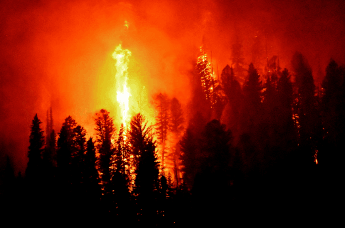
Forests are beyond beauty. They contribute a lot to nature predominantly to preserve our planet and the environment. Fires are a significant environmental challenge, when it comes to Forest fires, it is even worse with far-reaching consequences for ecosystems, air quality, and public health. Air quality is more than just a scientific metric; it is the silent yet powerful force shaping our planet, environment, health, and future. Every breath we take is a testament to the delicate balance of natural ecosystems and human activities.
India, with just 2.5% of the world’s geographical area yet home to 16% of the global population, faces unique ecological challenges. The nation’s forest cover spans 21.7% of its total land area, with classifications of 3% very dense, 9.4% moderately thick, and 9.3% open forest. Despite having only 1.8% of the global forest area, the country’s ecosystems must meet the intense demands of its growing population. Forest fires are a recurring issue in India, impacting between 380 and 445 districts out of 647 annually from 2003 to 2016. In 2018 alone, MODIS satellite data recorded approximately 37,059 fires, with certain regions experiencing disproportionately severe consequences.
India’s forests are geographically divided into four clusters:
- North Himalayan
- North-Eastern (NE)
- Southern
- Central
These clusters, accounting for 90% of India’s forest cover, reported 98% of fire detections between 2003 and 2016. Notably, the Northeastern cluster, which comprises 36% of India’s total forest cover, registered the highest number of fire detections at 40%, mainly due to shifting cultivation (jhum). This practice has drastically reduced ecosystem recovery time from 20–30 years to just 2–3 years due to population pressures.
Northeast India: A Case Study
The state of Mizoram, where forests cover 85% of the land dominated by Melocanna baccifera bamboo species. Mizoram presents a stark example of the interplay between ecological events and forest fires. After the mass flowering of Melocanna baccifera bamboo in 2006, fire frequencies spiked in 2007 due to widespread clearing and burning. Mizoram’s forest composition includes:

- Secondary Moist Bamboo Brakes (37%)
- Cachar Tropical Semi-Evergreen Forests (31%)
- East Himalayan Moist Mixed Deciduous Forest (31%)
Similarly, in Assam, with 36% forest cover, frequent fires are driven by agricultural practices, land use, and natural factors like dry conditions and lightning.
Study Area and Climate
The research focuses on three key locations in Northeast India:
- Guwahati, Assam:
- Area: 262 sq. km
- Average temperature: 16.2°C in winter, 26.7°C in summer
- Annual rainfall: 1724 cm
- Tezpur, Assam:
- Area: 40 sq. km
- Average temperature: 9–27°C in winter, 25–36°C in summer
- Annual rainfall: 183.6 cm
- Aizawl, Mizoram:
- Elevation: 839 m above sea level
- Average temperature: 10–25°C in winter, 24–35°C in summer
- Annual rainfall: 208 cm
Forest Fires and Pollution
Forest fires in Northeast India are predominantly caused by human activities like shifting cultivation, with additional factors such as climate and vegetation type playing a role. The pollutants released, including volatile organic compounds (VOCs), soot, ozone, and black carbon, not only impact local air quality but also travel long distances, affecting ecosystems far from the fire source.
Key pollutants measured include:
- Ozone (O3)
- Carbon Monoxide (CO)
- Nitrogen Oxides (NOx)
- PM2.5 and PM10
These pollutants were tracked in Guwahati, Aizawl, and Tezpur under the MAPAN program (2013–2016), using advanced monitoring systems. The Air Quality Index (AQI) from February to May, a period associated with slash and burning practices in NE-India, frequently fell into the “Poor” and “Very Poor” categories.
Modeling Forest Fire Impact
A deep learning model, Bi-directional Long Short-Term Memory (BiLSTM), was employed to predict forest fire impacts on vegetation. Using satellite data from MERRA-2, MODIS, and Sentinel-5P, the model assessed variables like:
- Aerosol concentration
- Carbon monoxide
- Soil moisture
- Leaf Area Index
- Temperature and humidity
By modeling the data, researchers aimed to understand and mitigate the far-reaching effects of forest fires.
Conclusion and Call to Action
The rising frequency of forest fires in states like Mizoram and Assam highlights the urgency of addressing anthropogenic and natural factors contributing to these events. Advanced technologies like BiLSTM can help monitor and predict the impact, but collective efforts are needed to reduce human-induced fire risks.

