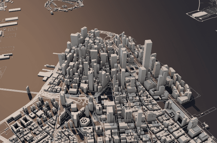
The rapid urbanization of modern society has led to an increased concentration of populations in cities. It is setting significant demands on infrastructure construction and maintenance. Compounding this challenge are the effects of extreme weather events, which further strain the care of essential facilities. Traditional ground monitoring and maintenance methods often struggle to meet these demands. Especially for expansive infrastructures like waste landfill facilities, where on-site inspections can be logistically challenging and resource-intensive. Researchers studied the use of Synthetic Aperture Radar (SAR) satellite data to identify and monitor risk zones associated with infrastructure.
In response to these challenges, researchers at the Korea Institute of Civil Engineering and Building Technology (KICT) have developed an innovative, cost-effective maintenance technology. It leverages satellite-based Synthetic Aperture Radar (SAR) data. This advanced study was published in the Sustainability. It promises to revolutionize the monitoring and maintenance of large-scale infrastructures by providing efficient, wide-area surveillance capabilities.
Understanding Satellite-Based SAR Technology
Synthetic Aperture Radar (SAR) is an active remote sensing technology. SAR utilizes microwaves to generate high-resolution images of the Earth’s surface. Unlike optical imaging systems, it can penetrate cloud cover and is not dependent on daylight. It allows consistent observations regardless of weather conditions or time of day. This makes it particularly valuable for monitoring infrastructures in diverse environmental settings.
Recent advancements have made satellite SAR data more accessible. For instance, the European Space Agency’s Sentinel satellites provide free, high-quality SAR data. This data enables researchers and engineers to incorporate advanced information into maintenance strategies without incurring prohibitive costs.
Application in Infrastructure Maintenance
KICT’s research team, including Dr. Sungpil Hwang and Dr. Wooseok Kim, has applied satellite SAR data to assess the impact of underground structures such as roads and subways. Their studies have analyzed surface subsidence resulting from excavation activities, including blasting, demonstrating the technology’s applicability across various structural conditions in urban areas. This capability facilitates widespread monitoring of surface displacement, which is crucial for early detection of potential infrastructure failures.
- Detection of Deformation: SAR data successfully identified areas experiencing ground subsidence or uplift, which are often precursors to structural issues in urban infrastructure.
- Correlation with Construction Activities: Many detected deformation zones corresponded with ongoing or recent construction and maintenance projects, highlighting the impact of such activities on ground stability.
- Risk Zone Mapping: The study produced detailed maps outlining high-risk areas, providing valuable information for urban planners and engineers to mitigate potential hazards proactively.
In collaboration with the University of Tokyo, KICT conducted analyses on actual waste disposal facilities to verify the technology’s effectiveness for landfill sites. Given the challenges posed by obstacles like trees in expansive areas, the researchers implemented scatterers—devices that enhance the reflection of radar signals. The application of scatterers yielded data with signal strengths more than 15 decibels higher than surrounding areas, indicating a significant improvement in monitoring accuracy. This suggests that maintenance of landfill facilities can be conducted with greater precision, potentially reducing costs by over 30% compared to traditional methods and eliminating management blind spots.
Implications for Future Infrastructure Management
The integration of satellite SAR data into infrastructure maintenance represents a significant advancement in the field. As Dr. Hwang notes, “The number of facilities requiring maintenance is increasing.” Utilizing satellite SAR data offers a pathway to more efficient and cost-effective maintenance solutions. Moreover, it addresses the growing issue of aging infrastructure.
Integrating SAR data analysis into urban infrastructure management offers several benefits:
- Proactive Maintenance: Early detection of ground deformations allows for timely interventions, preventing minor issues from escalating into major problems.
- Resource Optimization: Targeted maintenance based on precise data ensures efficient allocation of resources, reducing costs and environmental impact.
- Enhanced Safety: Identifying risk zones enhances public safety by preventing infrastructure failures that could lead to accidents or injuries.
KICT plans to further develop and implement a maintenance system for landfill facilities that incorporates scatterers, aiming to extend this innovative approach to various infrastructures across wide-area regions. This development aligns with the broader goal of enhancing the sustainability and resilience of urban infrastructure in the face of increasing environmental and societal pressures.
Conclusion
The research conducted by KICT highlights the potential of satellite-based technologies. These technologies can transform infrastructure maintenance. They offer a scalable solution that adapts to the complexities of modern urban environments. As cities expand, the demand for reliable infrastructure increases. Innovations like these will play a key role in ensuring the safety and functionality of essential services.

